
search
Cdg terminal 2 map
Charles de gaulle terminal 2 map. Cdg terminal 2 map (Île-de-France - France) to print. Cdg terminal 2 map (Île-de-France - France) to download. Cdg terminal 2 consists of seven terminals: 2A, 2B, 2C, 2D, 2E, 2F, and, at a distance of 800 m (0.5 mi), 2G. The first six terminals of cdg terminal 2 are joined by ground-level or below-ground passageways. Terminal 2G is reached by bus as its shown in cdg terminal 2 map. Cdg terminal 2 has an RER and TGV station, Aéroport Charles de Gaulle 2 – TGV, below the common area linking halls 2C–2F.
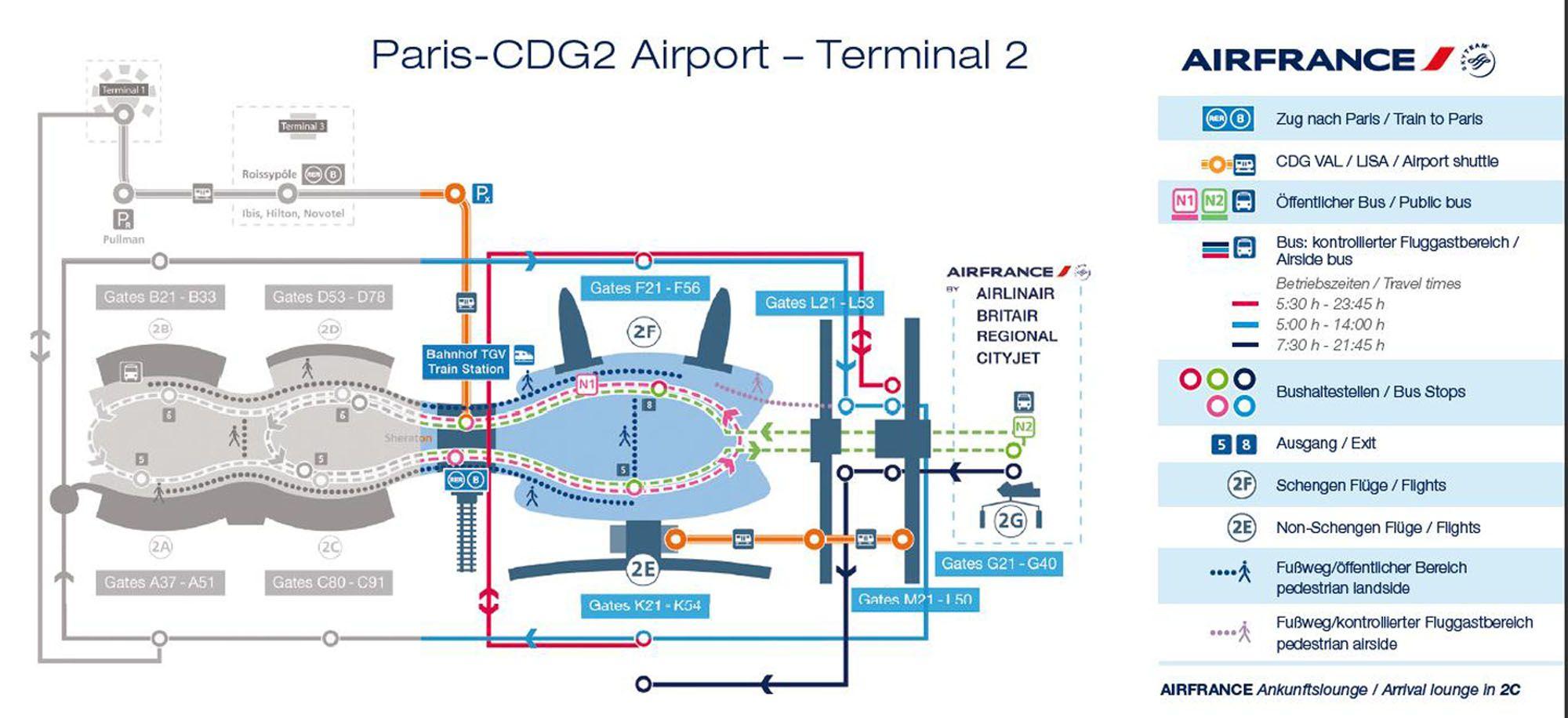
Given the renovation program that is undergoing cdg terminal 2, T2B is closed down and boarding hall L of T2E is also going to be totally renovated in order to offer several facilities and concessions to passengers (see cdg terminal 2 map). These projects are part of the renovation program of both Paris-Charles de Gaulle Airport and Paris-Orly Airport which begin in 2018 and it is expected to conclude on 2024.
Cdg terminal 2E on cdg terminal 2 map consists of a main building houses key functions such as immigration, baggage reclaim + three satellite buildings used for disembarking and boarding: cdg terminal 2E-hall K is beside the main building. Cdg terminal 2E-hall L is a satellite terminal, connected by transit train. Terminal 2E-hall M is a satellite terminal, connected by transit train.