
search
Cdg terminal map
Paris charles de gaulle airport map. Cdg terminal map (Île-de-France - France) to print. Cdg terminal map (Île-de-France - France) to download. In 2017, over 69 million passengers flew from cdg terminals. Cdg is also known as Roissy - Charles de Gaulle. Charles de Gaulle Airport has three terminals and the second one has several interconnected lobbies as its shown in cdg terminal map. A light-rail shuttle links these three terminals of cdg (except hall 2G) and is free.
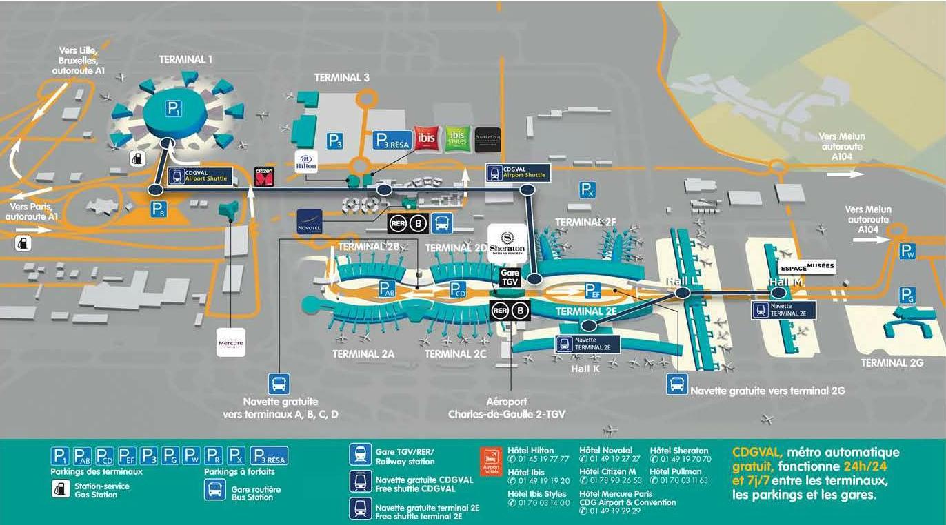
The cdg has three terminals. Terminal 1 is the oldest. Terminal 2 was originally built exclusively for Air France, since then it has been expanded significantly and now also hosts other airlines. The third terminal of cdg (T3, formerly T9) hosts charter and low-cost airlines. The CDGVAL is a light-rail shuttle that links the terminals, railway station and parking lots as its mentioned in cdg terminal map.
Started on 4 April 2007, the CDGVAL links all three terminals (except hall 2G) as you can see in cdg terminal map. There is only a single station for cdg terminal 2, near the rail station, so the walk distance to the more distant halls 2A–2B is more than 500 m (1,600 ft) (and both CDGVAL and bus are needed to reach 2G from cdg terminal 1).
Charles de Gaulle Airport or cdg is one of the two international airports serving Paris and the largest airport in France. Cdg is also one of the busiest airports in the world, being the second-busiest airport in Europe after London Heathrow. Due to its huge extension, about 32.38 square kilometres, its facilities are located within three départements and six communes as you can see in cdg terminal map. Currently, Paris Charles de Gaulle Airport consists of three terminal.