
search
Orly airport map
Map of orly airport. Orly airport map (Île-de-France - France) to print. Orly airport map (Île-de-France - France) to download. Paris Orly Airport (IATA: ORY, ICAO: LFPO), in French Aéroport de Paris Orly, commonly known as Orly, is one of the two international airports serving Paris, the capital of France, along with Charles de Gaulle Airport as its shown in orly airport map. Orly Airport is located 13 km (8 miles) south of Paris, partially in Orly and partially in Villeneuve-le-Roi.
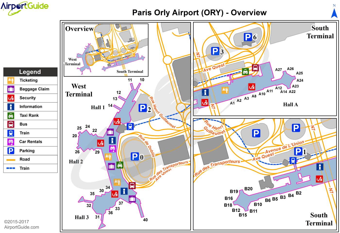
Orly Airport is a hub for Air France and a focus city for Air Caraïbes, Air France Hop, Chalair Aviation, Corsair International, easyJet, French Bee, Royal Air Maroc, Transavia France and Vueling (see orly airport map). Paris Orly Airport handled 31,853,049 passengers in 2019, being the 13th busiest airport in Europe and the second busiest airport in France.
Orly Airport is connected to the RER B train line at Antony train station by the Orlyval automatic shuttle as its shown in orly airport map. Orlyval is free to use between the two Orly terminals (west and south), however it costs 8,40 € between Antony and Orly airport. A shuttle connects Orly Airport to the RER C train at Pont de Rungis – Aéroport d'Orly. Tramway T7 is planned to open in 2013 and will connect the south terminal to Villejuif – Louis Aragon on Paris Métro Line 7.