
search
Paris city center map
Map of Paris city centre attractions. Paris city center map (Île-de-France - France) to print. Paris city center map (Île-de-France - France) to download. the 1st, 3rd, 4th, 5th, 6th, and 7th arrondissements are the most central with the higher numbers being further out and typically more residential. The central area of the city has safe and walkable neighborhoods that include the most notable restaurants, shopping, tourist attractions, and famous landmarks as its shown in Paris city center map. The most popular neighborhoods of Paris city center are the Marais on the right bank (in the 4th) and Saint-Germain on the left bank (in the 6th).
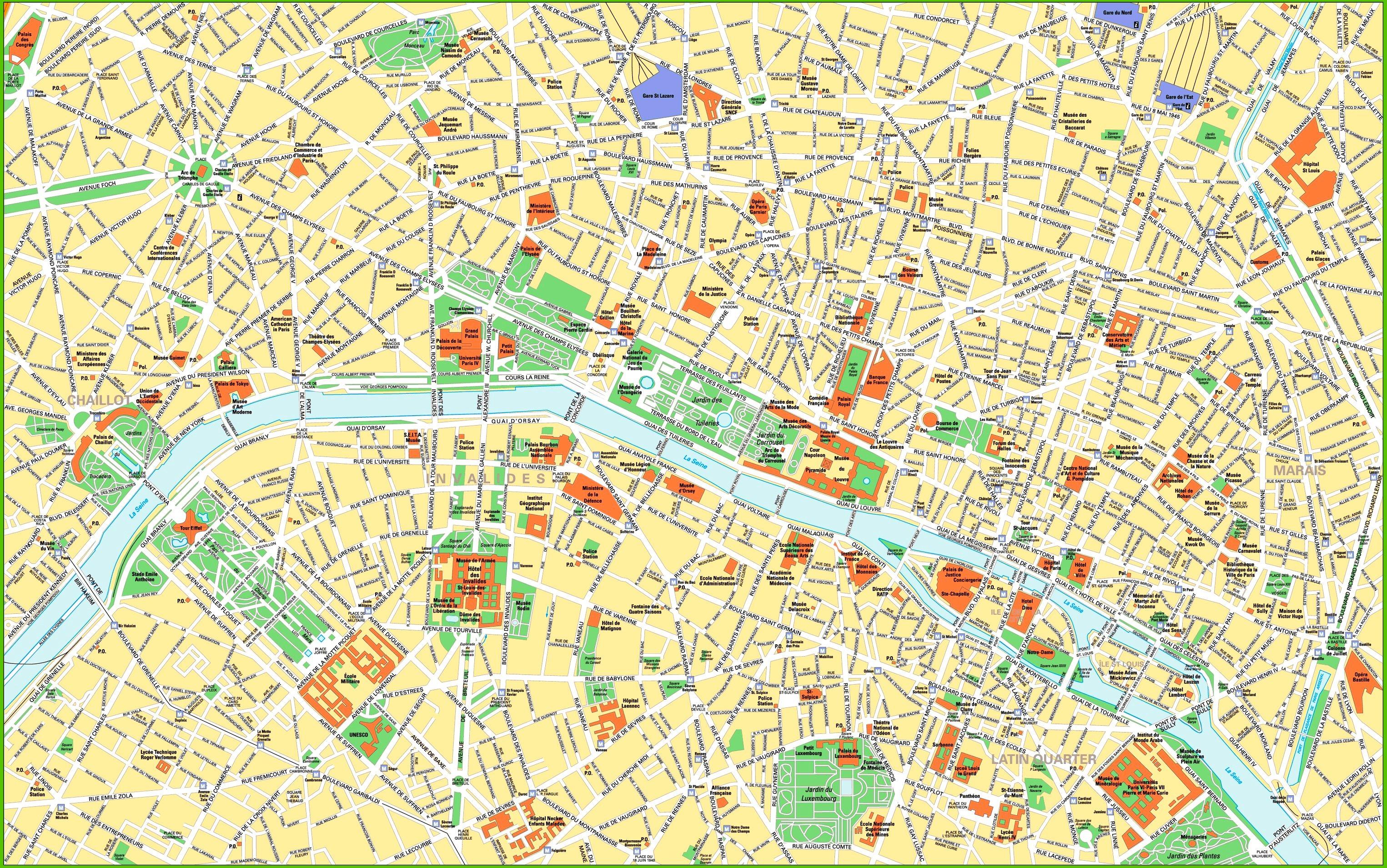
The Latin Quarter of Paris city center is great for those who want a central location with classic Parisian charm while seeking something a little quieter as its mentioned in Paris city center map. Find somewhere away from the student hangouts for which the area is typically associated with and you will find yourself strolling down cobblestone streets, through leafy squares, and taking in some of the most diverse architecture in the city which includes Roman ruins, gothic spires, and the innovative Institut du Monde Arabe.
Spread across the 3rd and 4th arrondissements, the Marais sits on the right bank of the Seine across from Notre Dame in Paris city center map. To your west, you will find the Louvre, the Tuileries and the Hôtel de Ville; to the east the buzzing bars of Bastille. And not far away from Paris city center there is the Centre Pompidou. The Marais itslef boasts the magnificent Place des Vosges and the refurbished Musée Picasso. When you are hungry, make for Breizh Café for heavenly crêpes and galettes, or the wonderfully eccentric Derrière for a modern twist on French cuisine served in a lavish flat.