search
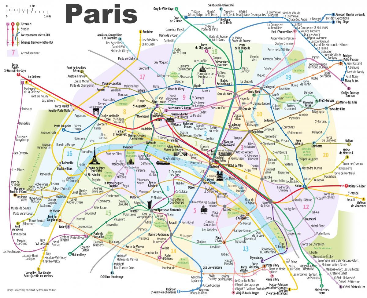
Paris metro map with monuments
Map of Paris metro with monuments. Paris metro map with monuments (Île-de-France - France) to print. Paris metro map with monuments (Île-de-France - France) to download. Line 9 passes through the monumental stations Trocadero, Alma Marceau (Pont de l'Alma), Franklin D. Roosevelt (on the Champs Elysée), Chaussée d'Antin La Fayette, République near the Canal Saint-Martin, and Nation as its mentioned in Paris metro map with monuments. Line 9 is one of the longest and busiest lines of the Paris metro that allows you to discover the Paris best monuments. Paris metro line 9 runs from the southern suburbs of Paris to the west of Paris and is thus the fourth longest of all RATP (Régie Autonome des Transports Parisiens) metro lines.
Visit Paris without leaving the metro. Dear Parisians, you should know that there are 27 stations, especially on lines 2 and 6, where you can discover incredible monuments, all without making the slightest effort as its shown in Paris metro map with monuments. Paris metro line 6 is the sixth busiest line in the network. It offers unique views of several monuments: From the Bir-Hakeim bridge, you can see the Eiffel Tower overlooking the Seine and Swan Island.


