
search
Paris metro station map
Map of Paris metro station. Paris metro station map (Île-de-France - France) to print. Paris metro station map (Île-de-France - France) to download. Stations as its shown in Paris metro station map are often named after a square or a street, which, in turn, is named for something (or someone) else. Details given are usually of the latter. A number of Paris metro stations, such as Avron or Vaugirard, are named after Paris neighborhoods (though not necessarily located in them), whose names, in turn, usually go back to former villages or hamlets that have long since been incorporated into the city of Paris.
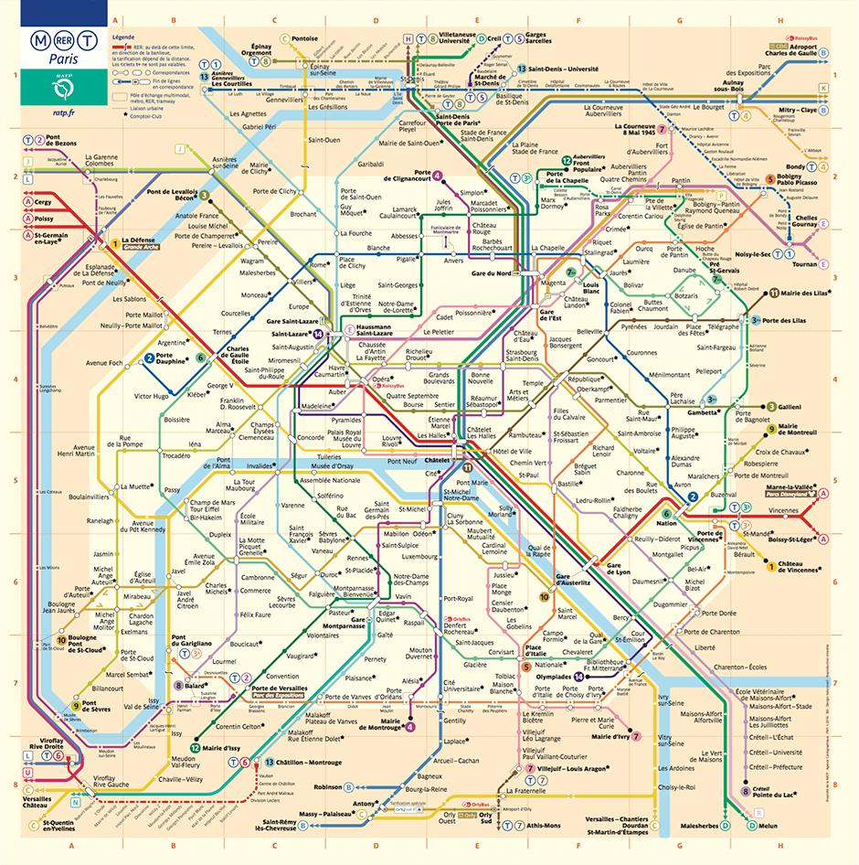
Paris metro line 1 has 25 stations (2 overhead), 13 of which connect with 11 other metro lines, 4 RER lines, one tramway line and two SNCF stations. The metro station length in Km: 16.4 (0.6 by air). Paris metro line 2 has 25 stations (4 overhead), including 10 connecting with 11 other metro lines, 4 RER lines and one train station as its shown in Paris metro station map. Length in km: 12.3 (2.2 by air).
The use of double names, such as Reuilly - Diderot or Strasbourg — Saint-Denis, often goes back to two (or more) metro stations on separate lines that were originally named independently and became associated as interchange stations. For example, the Paris metro station Marcadet - Poissonniers is an interchange station consisting of the original Marcadet on Line 4 and the original Poissonniers on Line 12 as its mentioned in Paris metro station map.