
search
Paris metro zone map
Paris zone map metro. Paris metro zone map (Île-de-France - France) to print. Paris metro zone map (Île-de-France - France) to download. The Ile-de-France region is divided into 5 transport zone. On Paris metro zone map Paris is in zone 1, Orly and Versailles in zone 4, Charles de Gaulle airport in zone 5. The Paris Metro operates exclusively in zone 1 and 2. Tickets are sold at all stations. There is a wide variety of tickets, simple ticket (ticket t +), day pass, tourist pass, etc .
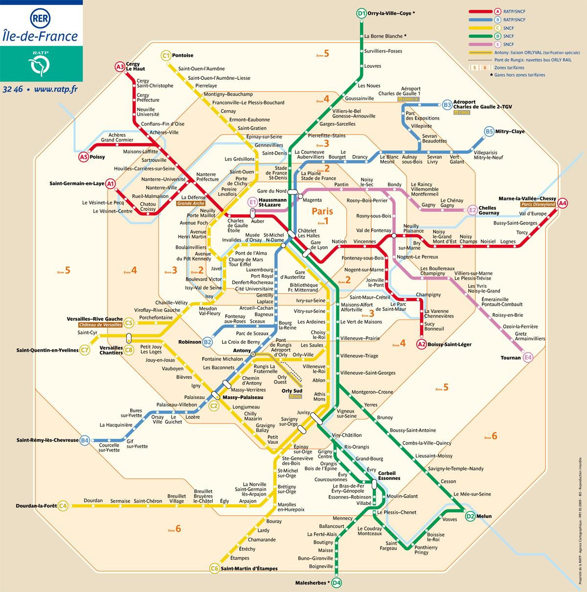
Paris and the surrounding area transport like metro is divided into 5 circular zones. On Paris metro zone map ,The RATP/STIF transit authorities recently changed zone prices to be either all-zone or one of 3 sub-zones excluding central Paris Zone 1 (zones 2-5, 3-5, 4-5). There is a slight discount for travelers not needing central Paris coverage on their passes.
The zoning of transport metro in Ile-de-France corresponds to a series of concentric zone ever further from Paris and whose center would be the city of Paris. On Paris metro zone map the further away the station is, the higher the zone number. If you take a ticket to travel for one zone, you can not move to another zone.If your ticket is valid for zones 4 and 5, you will not be able to come to Paris with.
Paris Metro (urban city subway) is all a single zone although it has stations in both Zones 1-2 as shown on this more detailed zone map including Paris Metro, RER and Transilien (intercity) trains (900KB PDF, opens a new window). Paris Metro tickets are valid for travel anywhere within Zone 1 and all of the Metro system is a single zone requiring only a single Metro Ticket / Ticket t+ (even if the Metro station you’re at is outside of Zone 1, I realize this is confusing).