
search
Roman Paris map
Map of roman Paris. Roman Paris map (Île-de-France - France) to print. Roman Paris map (Île-de-France - France) to download. If the original location of the Gallic Lutetia is uncertain, that of the Roman Lutetia is no doubt. Roman will indeed build a new city on the left bank of the Seine (current Latin Quarter), with the typical plan of Roman cities of that time, while the Parisii lived on the Île de la Cité as you can see in roman Paris map. Around a large north-south axis called the Cardo Maximus, which is today the Rue Saint-Martin and Saint-Jacques Street, Lutetia is a beautiful Roman city populated by about 10 000 inhabitants.
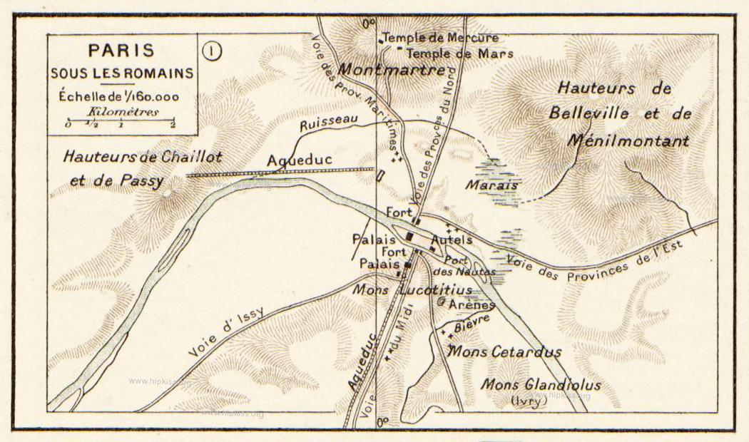
The city of Paris began in the 3rd century BCE when a Celtic tribe called the Parisii built a fortified settlement on the Ile de la Cite as its shown in roman Paris map. The Romans conquered the Parisii in 52 CE and they built a town on the River Seine. The Romans called Paris Lutetia. However Roman Paris was not a particularly large or important town. It had a population of not more than 10,000. In the late 3rd century Paris and the surrounding region were converted to Christianity. However by then the Roman Empire was in decline. In 486 a race called the Franks captured Paris.