
search
Rer c map
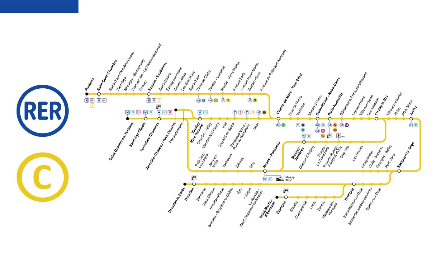
Map of rer c . Rer c map (Île-de-France - France) to print. Rer c map (Île-de-France - France) to download. The RER C map is a regional train line running through the city of Paris from north-west to south. on Paris rer map It connects the cities of Pontoise in the north, Versailles, Saint-Quentin-en-Yvelines, Dourdan-la-Forêt and Saint-Martin-d'Etampes in the south, through the city center of Paris. The RER C is known for serving some of the most beautiful monuments of Paris and its surroundings.
The RER C makes it possible to reach Paris Orly airport from the capital by taking a shuttle bus called "Paris by the train" to the station "Pont de Rungis" The travel time is estimated about 40 minutes from Austerlitz station to Orly airport by RER C.On RER C map stops at bus stops every 15 minutes. The price of the RER C for one way is about 7 € with a combined ticket "metro + RER C + shuttle bus".
The RER C is one of five lines in the RER rapid transit system serving Paris, France. RER C is operated by SNCF. According to Map of rer c , The line connects the north-west terminals of Pontoise (C1), Versailles-Château (C5) and Saint-Quentin-en-Yvelines (C7) to the ,southern terminus Massy-Palaiseau (C2), Dourdan-la-Forêt (C4) , St. Martin of Etampes (C6) and Versailles - Chantiers (C8).
Rer line c is used by more than 500 trains a day. Rer line c is the line with the most stations in the network. Orly airport is accessible via this line. It allows the inhabitants of Pontoise and its surroundings to reach Paris. To the west, this line serves Versailles-Rive Gauche, Saint-Quentin-en-Yvelines and Versailles Chantiers. Further south, rer line C extends as far as Dourdan la Forêt and Saint-Martin d'Estampes in zone 6 as its shown in rer c map. This line connects with all other RER lines via Auber, Gare de Lyon and Châtelet les Halles stations.