
search
Rer line a map
Map of rer line a . Rer line a map (Île-de-France - France) to print. Rer line a map (Île-de-France - France) to download. Paris express train has five lines (A, B, C, D and E), over 250 stations and runs over 365 miles of track as its shown in rer line a map. The most popular lines for tourists are A, B and C. Rer line A: Connects Disneyland Paris with the city centre. Rer line B: Connects Charles de Gaulle Airport with the city centre. Rer line C: Its destinations are Orly Airport and the Palace of Versaille.
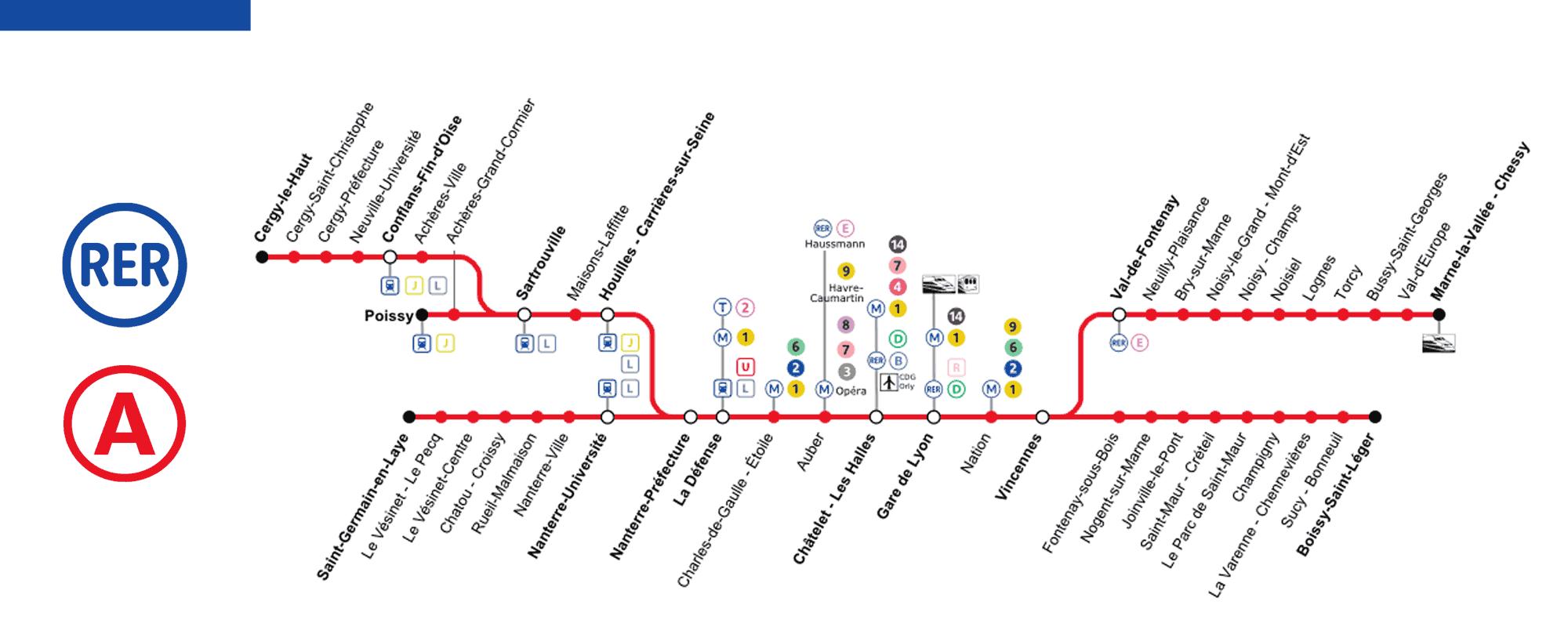
The rer five lines, named A, B, C, D and E, have almost 600 kilometers of track and serve more than 240 stations as its shown in rer line a map. RATP (lines A and B south) and SNCF Mobility division (lines B north, C, D and E) manage and organize daily transportation for more than 2.5 million passengers on a defined part of the network. Rer lines A and B were inaugurated in 1977 by President Valéry Giscard d'Estaing, nearly 80 years after the first metro line was put into service for the Universal Exhibition of 1900.