
search
T2 Paris tramway map
Map of t2 Paris tramway. T2 Paris tramway map (Île-de-France - France) to print. T2 Paris tramway map (Île-de-France - France) to download. Extended in 2009 from Issy - Val de Seine to Paris Porte de Versailles and in 2012 from La Défense to Pont de Bezons, the T2 line of the Tramway for 24 stops, proposes to link the Pont de Bezons at the Parc des Expositions at Porte de Versailles in about 45 minutes. On t2 Paris tramway map the T2 tram runs every day of the week, including Sundays and public holidays.
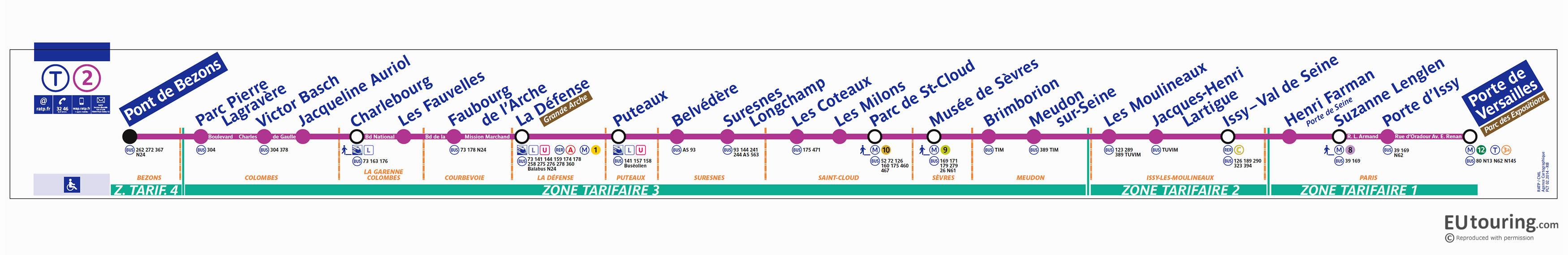
The Paris tramway T2 was inaugurated in July 1997 on the occasion of World Youth Day. The 24 stations in the Map of t2 Paris tramway spread over 18 km connect the Porte de Versailles bridge Bezons (between Nanterre and Bezons in the Val d'Oise), through La Defense, Suresnes, St. Cloud, Sèvres, Meudon and Issy-les-Moulineaux .