
search
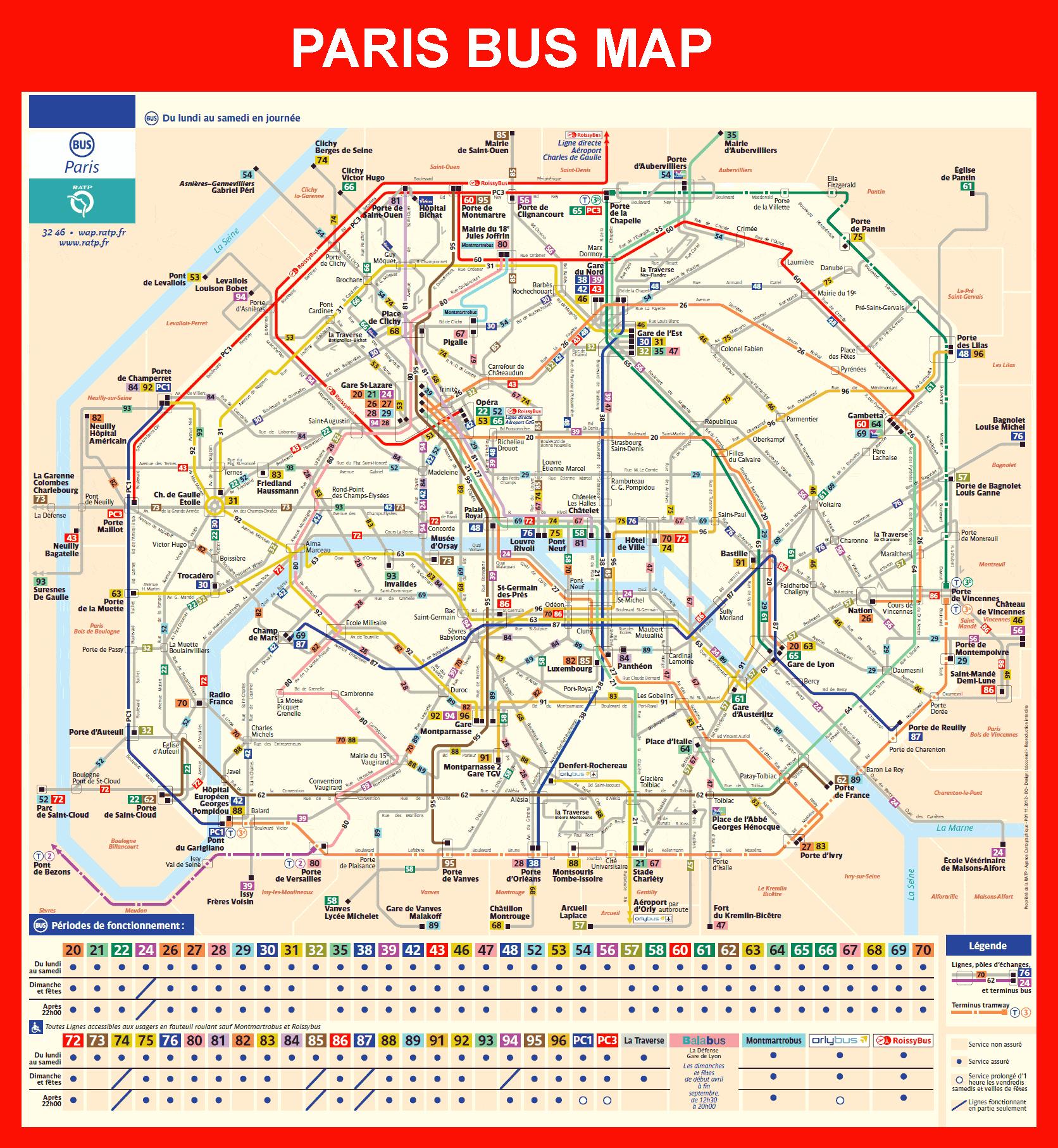
Paris bus station map
Map of Paris bus station. Paris bus station map (Île-de-France - France) to print. Paris bus station map (Île-de-France - France) to download. Paris, Gare routière internationale Gallieni Bus terminal is located about 13.68 km from the town centre, which is only a 26 minute drive as its shown in Paris bus station map. At Paris, bus station you can find: ATM, toilet, luggage storage and coffee bar. Near Paris, coach station you can find: mall or supermarket (0.83 km) and hotels or hostels (click here to see available accommodation). In case you want to continue your travel you have the following transport services available near Paris, bus station: metro station (0.62 km) and public bus stop (0.94 km).
Paris, Bercy Terminal Bus terminal is located about 6.48 km from the town centre, which is only a 20 minute drive as its mentioned in Paris bus station map. Near Paris, coach station you can find: kiosk, coffee bar, fast food, parking lot and hotels or hostels (click here to see available accommodation). In case you want to continue your travel you have the following transport services available near Paris, bus station: taxi stand and train station (139 m - Gare de Bercy).