
search
Airports in Paris France map
Paris airport locations map. Airports in Paris France map (Île-de-France - France) to print. Airports in Paris France map (Île-de-France - France) to download. Paris has two airports, Roissy Charles de Gaulle (CDG) to the north and Orly (ORY) to the south as its shown in airports in Paris France map. Roissy - Charles de Gaulle airport (CDG) is the main international airport for Paris, and the second busiest airport in Europe after London Heathrow. Orly is mostly used for domestic traffic and low cost operators, but also has flights to a number of European destinations, with French and foreign airlines; there are also a few long-haul flights from Orly.
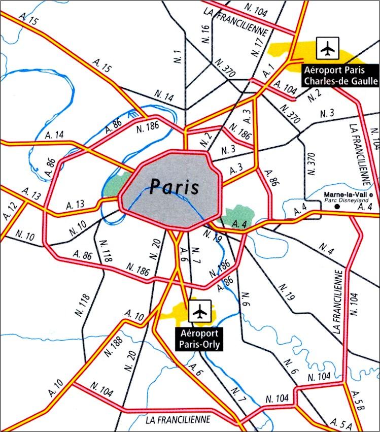
Orly Airport is the best suited airport in Paris for business travellers as it is nearer to the city centre as its mentioned in airports in Paris France map. Since it is not as busy as the CDG Airport, security and flight delays are also lower. Most travellers recommend Orly Airport if the flight fare is comparable or lower than the CDG Airport.
Beauvais is a small airport 90 km northwest of the city of Paris that has become the gateway to the city for a number of budget airlines including Ryanair, Blue Air and Wizzair. It has 'annexed' the city name the way many regional airports that are close to major cities have, to make them more readily recognised from a location point of view, with no intention to deceive we are sure. It is actually in the village of Tillé just outside the town of Beauvais (see airports in Paris France map).