
search
Arrondissement map
Paris France arrondissement map. Arrondissement map (Île-de-France - France) to print. Arrondissement map (Île-de-France - France) to download. The city of Paris itself is officially divided into 20 districts called arrondissements as its shown in arrondissement map, numbered from 1 to 20 in a clockwise spiral from the centre of the city (which is known as Kilometre Zero and is located at the front of Notre Dame). Arrondissements are named according to their number. You might, for example, stay in the "5th", which would be written as 5e in French.
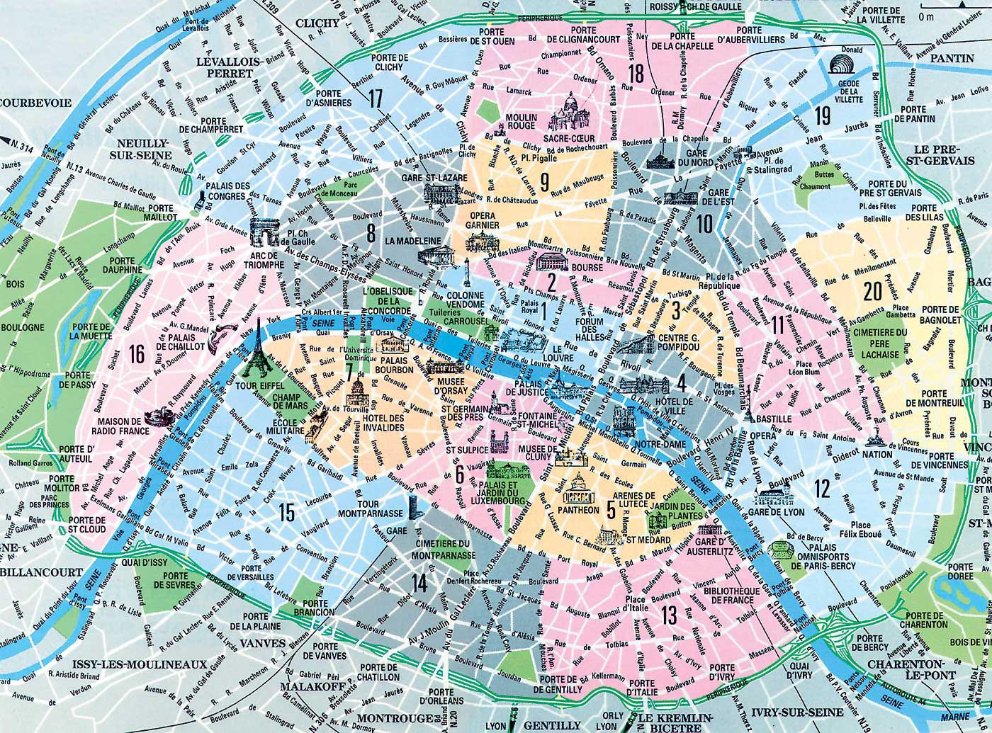
Most of the Paris we see today is a result of a nineteenth-century renovation, but its boulevards and arrondissements as its mentioned in arrondissement map, were but a new grid bisecting quarters built by centuries of Parisian habit; as a result of this, Paris has many quarters that are not necessarily mentioned on any administrative map.
Paris has twenty Arrondissements that cut out the capital by following a spiral from the center and turning clockwise as you can see in arrondissement map. These twenty Parisian arrondissements are all different and each has its own particular attractions in terms of sightseeing, places to go out, restaurants and homes. This subdivision of Paris into arrondissements dates back to 1795. At that time Paris only had 12 districts but it was not until 1859 that the capital had its current perimeter and 20 districts.