
search
Louvre museum map
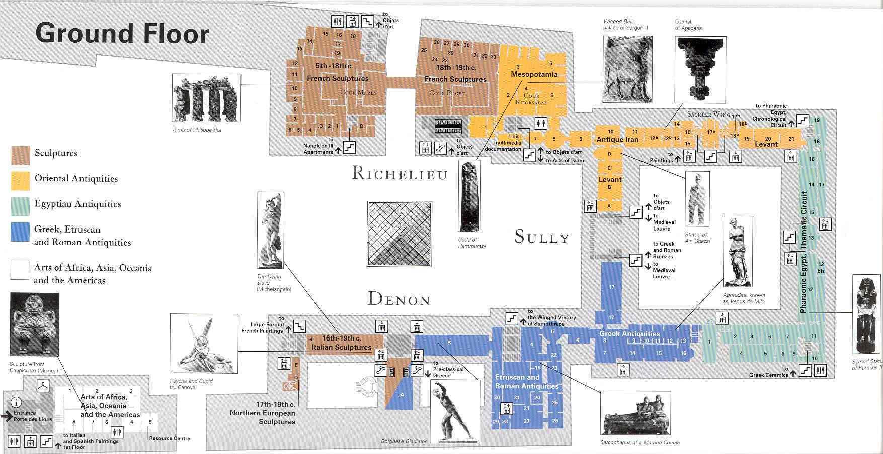
Map of louvre museum. Louvre museum map (Île-de-France - France) to print. Louvre museum map (Île-de-France - France) to download. The louvre museum, or officially the Grand Louvre — in English, Great Louvre, or simply the Louvre — is one of the world largest museums, the most visited museum in the world, and a historic monument. Louvre museum is a central landmark of Paris, France and is located on the Right Bank of the Seine in the 1st arrondissement (district) as its shown in louvre museum map. Nearly 35,000 objects from prehistory to the 19th century are exhibited over an area of 60,600 square metres (652,300 square feet).
Opened at the end of the eighteenth century, the louvre museum receives over 8 million visitors each year. Featuring the French monarch art collection and the result of the pillaging which was carried out during Napoleon Empire, the Louvre Museum opened in 1793. Since its inauguration, the museum was free for the public during a few days a week and was considered revolutionary for its time (see louvre museum map).
The louvre museum is housed in the Louvre Palace (Palais du Louvre) which began as a fortress built in the late 12th century under Philip II. Remnants of the fortress are still visible in the louvre museum. The building was extended many times to form the present Louvre Palace as you can see in the louvre museum map. In 1672, Louis XIV chose the Palace of Versailles for his household, leaving the Louvre primarily as a place to display the royal collection, including, from 1692, a collection of antique sculpture.