
search
Paris bridges map
Map of Paris bridges. Paris bridges map (Île-de-France - France) to print. Paris bridges map (Île-de-France - France) to download. With the exception of a few newer bridges, most of the bridges over the Seine are reminders of Paris past. The Parisii tribe who inhabited Ile de la Cité built the first bridges in Paris, the Petit Pont and the Grand Pont, in 52 BC. Today there are 37 bridges spanning the Seine as its shown in Paris bridges map, which flows for 13 km through Paris. They make for an exceptional heritage and are a magnificent sight, by day as by night.
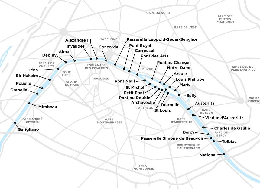
The best known bridges in Paris include the oldest one, Pont Neuf, the construction of which began in 1578; Pont Alexandre III, this Paris bridge was built for the 1900 Universal Exhibition, Pont Marie, built to provide access to Ile Saint Louis when it began to be urbanized in the 17th century, and Pont de l'Alma, a magnet for tourists, as it is the place where Princess Diana met her tragic death in 1997 as its mentioned in Paris bridges map.