
search
Paris bus map
Map bus Paris. Paris bus map (Île-de-France - France) to print. Paris bus map (Île-de-France - France) to download. On paris bus map , Parisian buses survey the entire capital and its periphery. The bus network complements the already wide range of urban transport services: RER, metro and tramways. The main operator of this road network is the Régie Autonome des Transports Parisiens, better known under the acronym RATP. A group of companies called Optile also operates Paris bus.
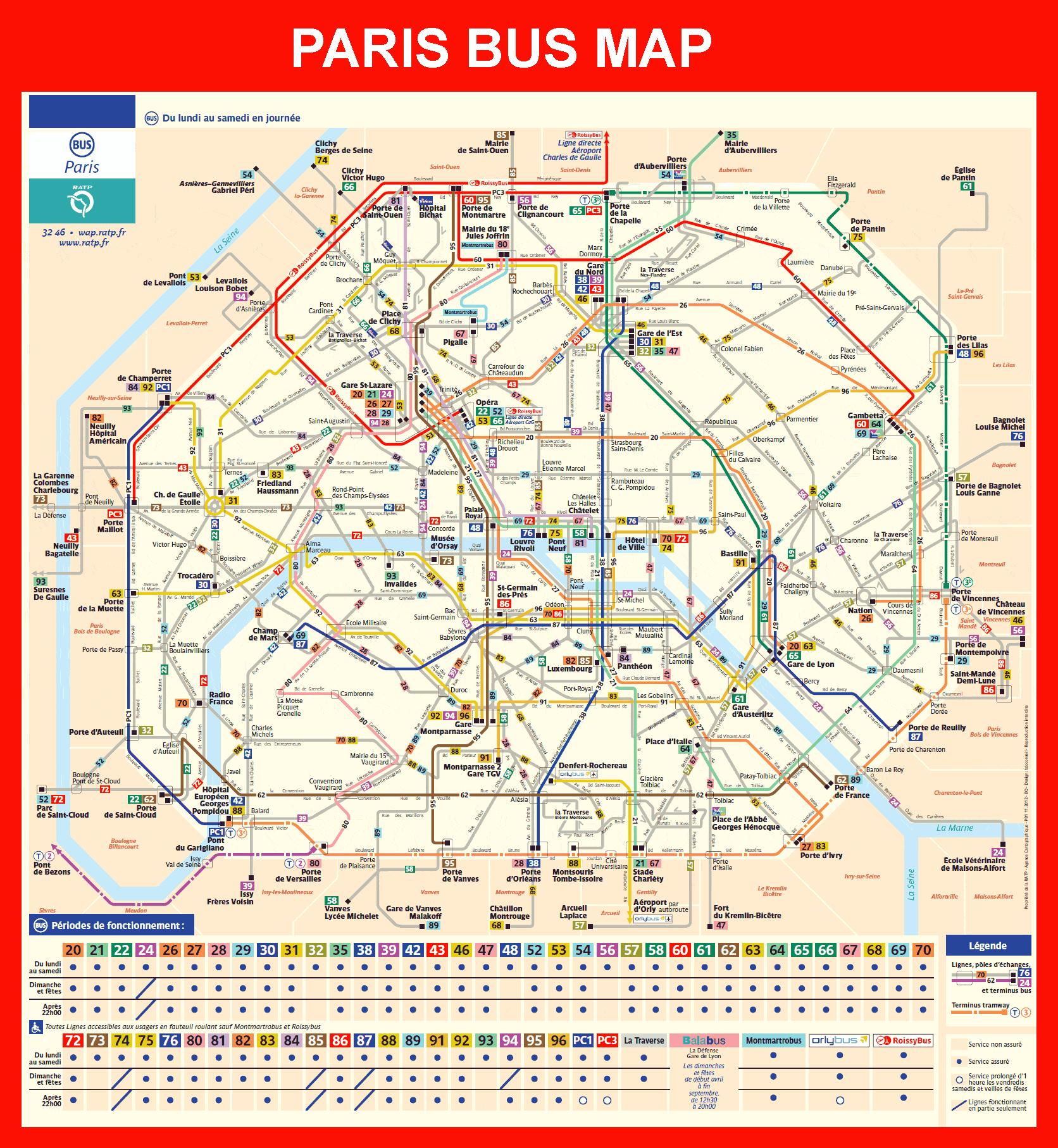
The bus is a complementary means of public transport to the metro. according to Paris bus map It allows to move in Paris and its suburbs day and night. About sixty bus lines crisscross Paris and about 290 lines the suburbs of Paris. At night, 31 Noctilien lines are at your disposal to return home, whether you are staying in Paris or in the suburbs.
There are numerous bus lines and many buses go through the centre of Paris as its mentioned in Paris bus map, along the banks of the Seine, and through historic districts. 64 bus lines run alongside and complement the metro network. The installation of special bus lanes along main Paris roads has improved journey times. For an idea of your journey time, allow around 5 minutes per stop, sometimes more if the traffic is busy.
Buses in Paris operate from Monday to Saturday from around 7am until 8.30pm. Some lines operate in the evening between 8.30pm and 12.30am, in particular those departing from stations or which serve major metro/RER interchanges, as well as the 3 outer PC lines as its mentioned in Paris bus map. Almost half of Paris bus lines operate on Sundays and public holidays.