
search
Paris elevation map
Map of Paris elevation. Paris elevation map (Île-de-France - France) to print. Paris elevation map (Île-de-France - France) to download. Paris elevation is actually pretty low. It’s located according Paris elevation map a large vaguely flat plain going from Atlantic Ocean to border with Belgium and Germany. Paris city average altitude is about 33 m above the sea level, with some highest point (Montmartre, Buttes Chaumont, etc…) reaching about 130 m ab.sl .If some nearby locations around Paris are as low as Paris.
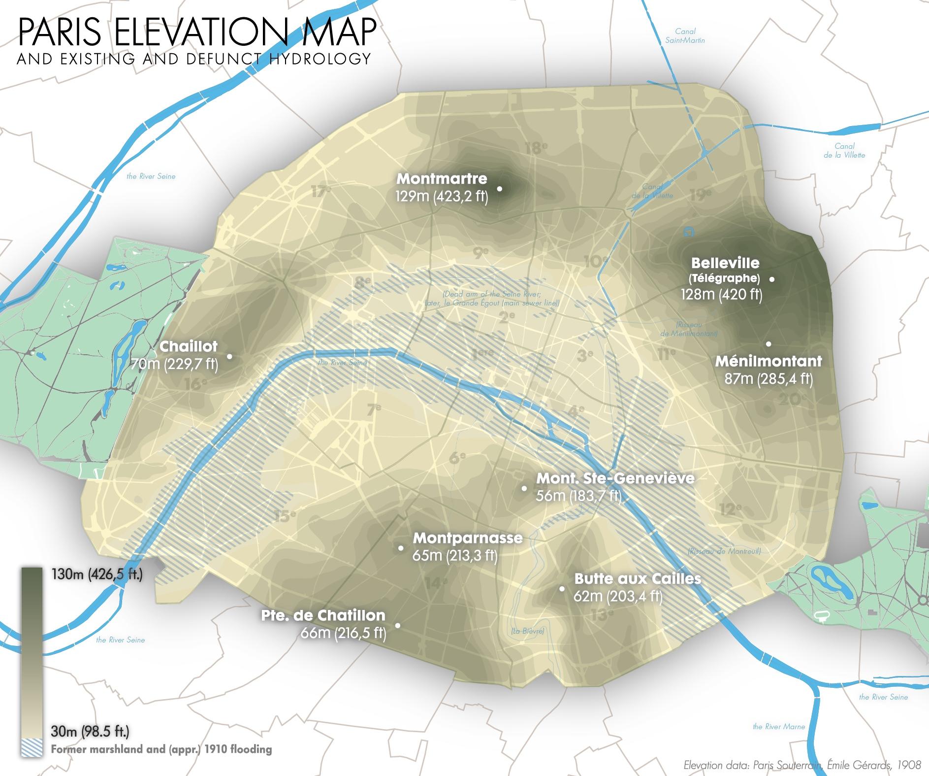
Montmartre elevation is a district of the 18th arrondissement of Paris covering the hill of Butte Montmartre, which is one of the main tourist attractions in Paris: 130.53 meters, altitude of the natural ground inside the cemetery of Calvary.In the Map of Paris elevation The two most famous accesses to the top of the hill are the funicular - an automatic inclined lift