
search
Paris metro train map
Paris train line map. Paris metro train map (Île-de-France - France) to print. Paris metro train map (Île-de-France - France) to download. The RER Paris has 5 train lines as its shown in Paris metro train map: RER A, RER B, RER C, RER D, RER E. Paris RER stations are often shared with Metro lines such as at Paris’ largest underground station, Chatelet Les Halles. In the below photo the sign shows RER A, RER B and RER D along with five Paris Metro lines 1, 4, 7, 11 & 14 in one Paris station – Chatelet Les Halles.
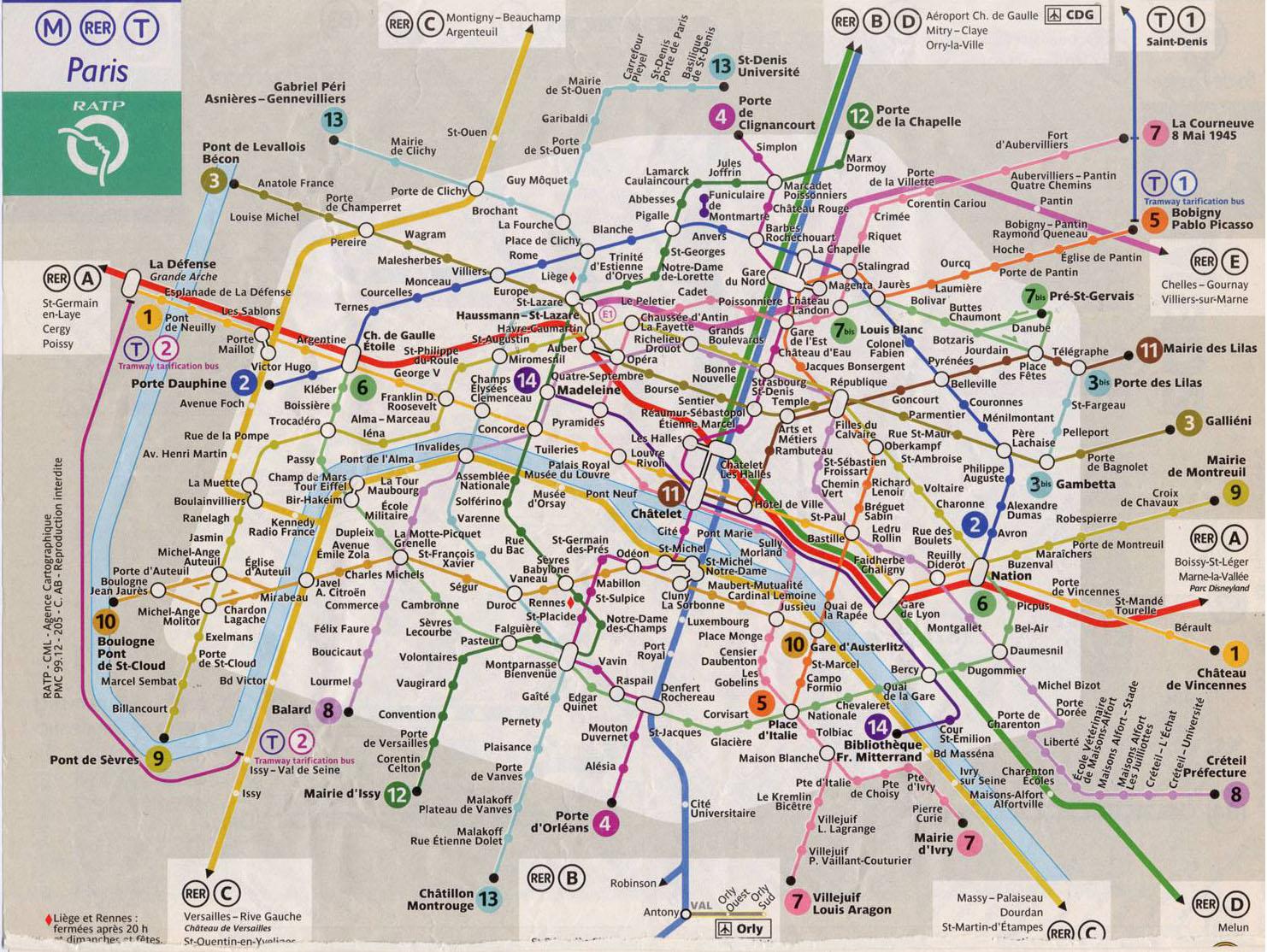
The RER A line shown on this Paris metro train map is the red line, which travels east to west through metro Paris, from Marne La Vallée (formerly known as Euro Disney, now called Disneyland Paris) to St Germain-en-Laye out west. The RER B runs north (B3) to Charles de Gaulle airport and south (B4) to Orly Airport (via the Orlyval train from 'Antony' station) then on to Saint Remy sur Chevreuse. Main stations/stops on this line in central Paris are Gare du Nord, Chatelet-les-Halles and St. Miche-Notre Damel.
The RER C is main tourist stations/stops in central Paris on this line are St. Michel-Notre Dame, Musee d'Orsay, Invalides and Eiffel Tower as you can see in Paris metro train map. This line also for the chateau at Versailles C5 and for Gare d'Austerlitz . The RER D Main stations/stops on this line in central Paris are Gare du Nord, Chatelet-les-Halles and Gare de Lyon. This line serves north and south suburbs of the city. Finally the RER E Main stations/stops on this line in central Paris are Haussmann-Saint-Lazare which is connected to Gare Saint-Lazare (train station) via walkways and Magenta which is connected to Gare du Nord (train station) via walkway station links. This line serves suburbs to the east of the city.