
search
Paris train map
Train map Paris France. Paris train map (Île-de-France - France) to print. Paris train map (Île-de-France - France) to download. The RER, Paris commuter train system, consists of five express trains that travel within Paris and the greater region (contrary to the metro, which stops just outside the city limits) as its shown in Paris train map. The RER train of Paris can get you to your destination much faster since it stops at far fewer stops than the Metro. Operating hours for RER train lines vary, but on average the commuter trains run from 4:50 a.m. to midnight or 12:30 a.m.
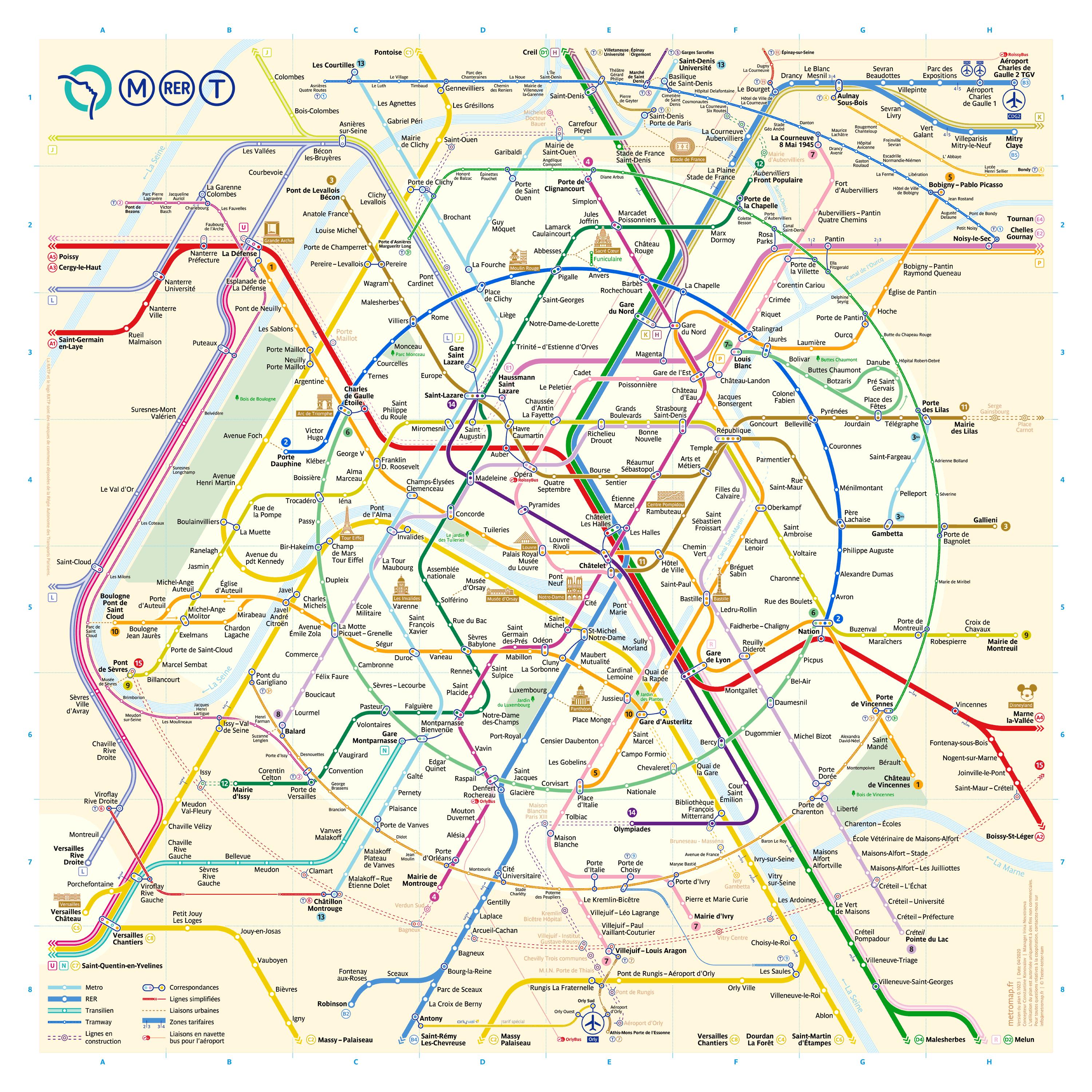
The primary hub for outgoing and incoming RER trains is the Châtelet-Les Halles station as its mentioned in Paris train map. Other major hubs include Gare du Nord, St. Michel/Notre Dame, and Gare de Lyon. The RER train of Paris, which is run by a different (public) company than the Paris Metro, can be a bit complicated at first, but the time gained is generally worth it.
Like the metro, RER train lines are identifiable by letters (A through E) and end-of-line names. However, the RER train of Paris is more complicated than the metro because each line breaks into different directions at a certain point, making it easy to get lost (and waste funds and time) if you hop on the wrong train. In Paris the RER acts as an express underground or subway train as you can see in Paris train map.
To avoid surprises, check your direction carefully before boarding, and use the train itineraries located in RER stations to help you get oriented as its shown in Paris train map. If in doubt, ask for help. If you have a smartphone or tablet, consider installing a Paris Metro/RER train app. Many are free, and are very handy to have so you can navigate what even locals often consider to be a confusing system.