
search
Paris tram map
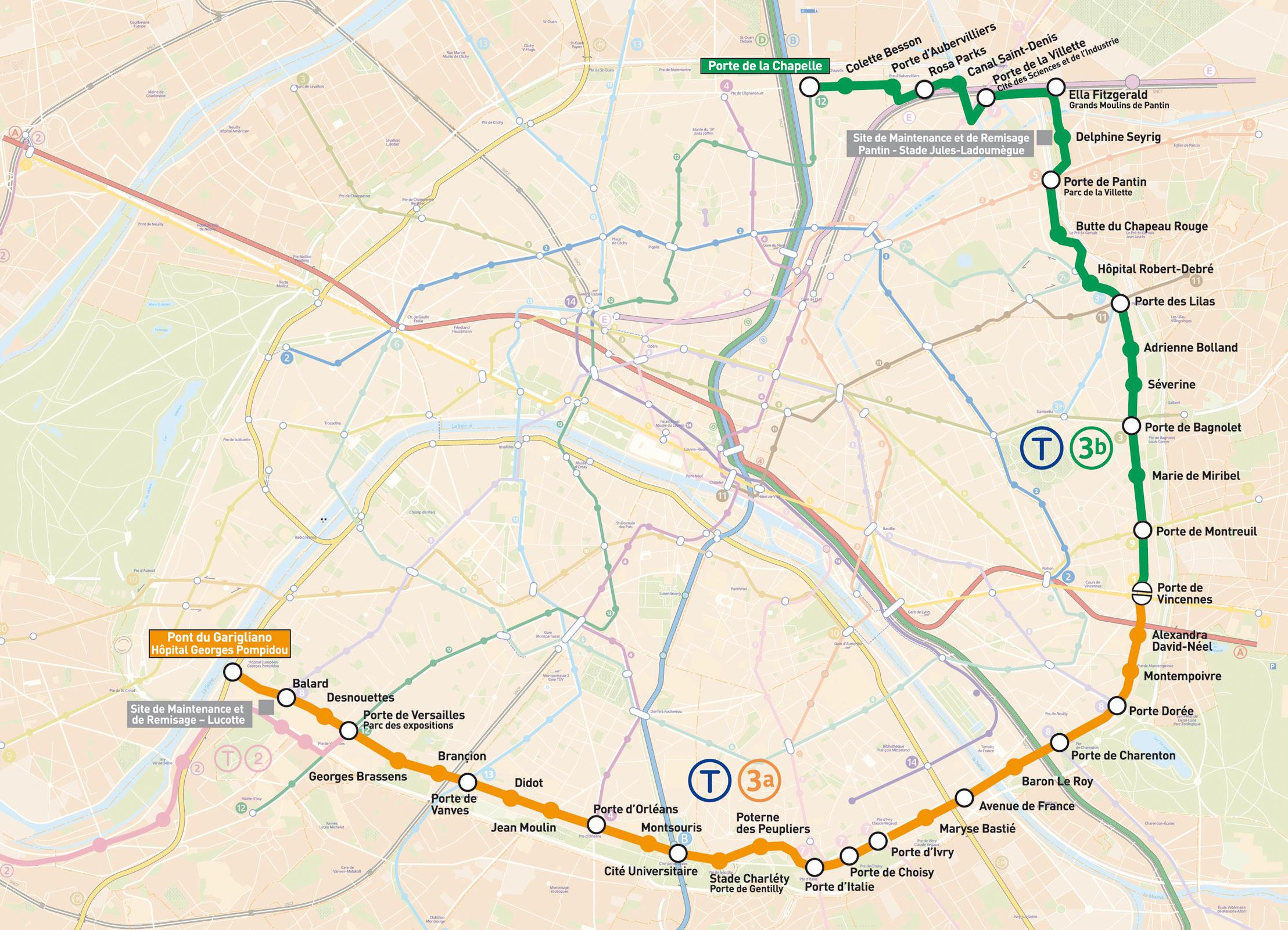
Map of Paris tram. Paris tram map (Île-de-France - France) to print. Paris tram map (Île-de-France - France) to download. The trams in Paris completely disappeared in 1957, but were re-introduced at the end of the 20th century, when the RATP company decided that this comfortable, clean (does not produce fumes) and inexpensive to build means of transport was ideal. Up until the twentieth century, Paris had a large network of tram lines as its shown in Paris tram map. During the 1950s, these were slowly but surely replaced by the metro lines and the tramways disappeared. The last tram travelled to Versailles in 1957.
Paris trams are not very interesting for visitors (see Paris tram map). Currently, the Paris tram lines only run in the city outskirts and therefore visitors dont usually take them. The best tram line for tourists could be line 1, as its final destination is Basilica of Saint Denis, but you can also take the Paris metro line 13 to get to the Basilica.
The Paris region is served by a light rail network of four lines, the Paris tram: Line T1 runs from Saint-Denis to Noisy-le-Sec, line T2 runs from La Défense to Porte de Versailles, line T3 runs from Pont du Garigliano to Porte d'Ivry, line T4 runs from Bondy to Aulnay-sous-Bois as its shown in Paris tram map. Six new light rail lines are currently in various stages of development in Paris.