
search
Paris transport map
Paris public transit map. Paris transport map (Île-de-France - France) to print. Paris transport map (Île-de-France - France) to download. Paris boasts one of the world safest and most efficient public transport systems (see Paris transport map). While the metro subway system is extensive, it is generally safe and easy to use once you familiarize yourself with it a bit. Trains usually arrive on time; buses are well-appointed and spacious, and commuter express ("RER") trains service Paris most important stops in record time.
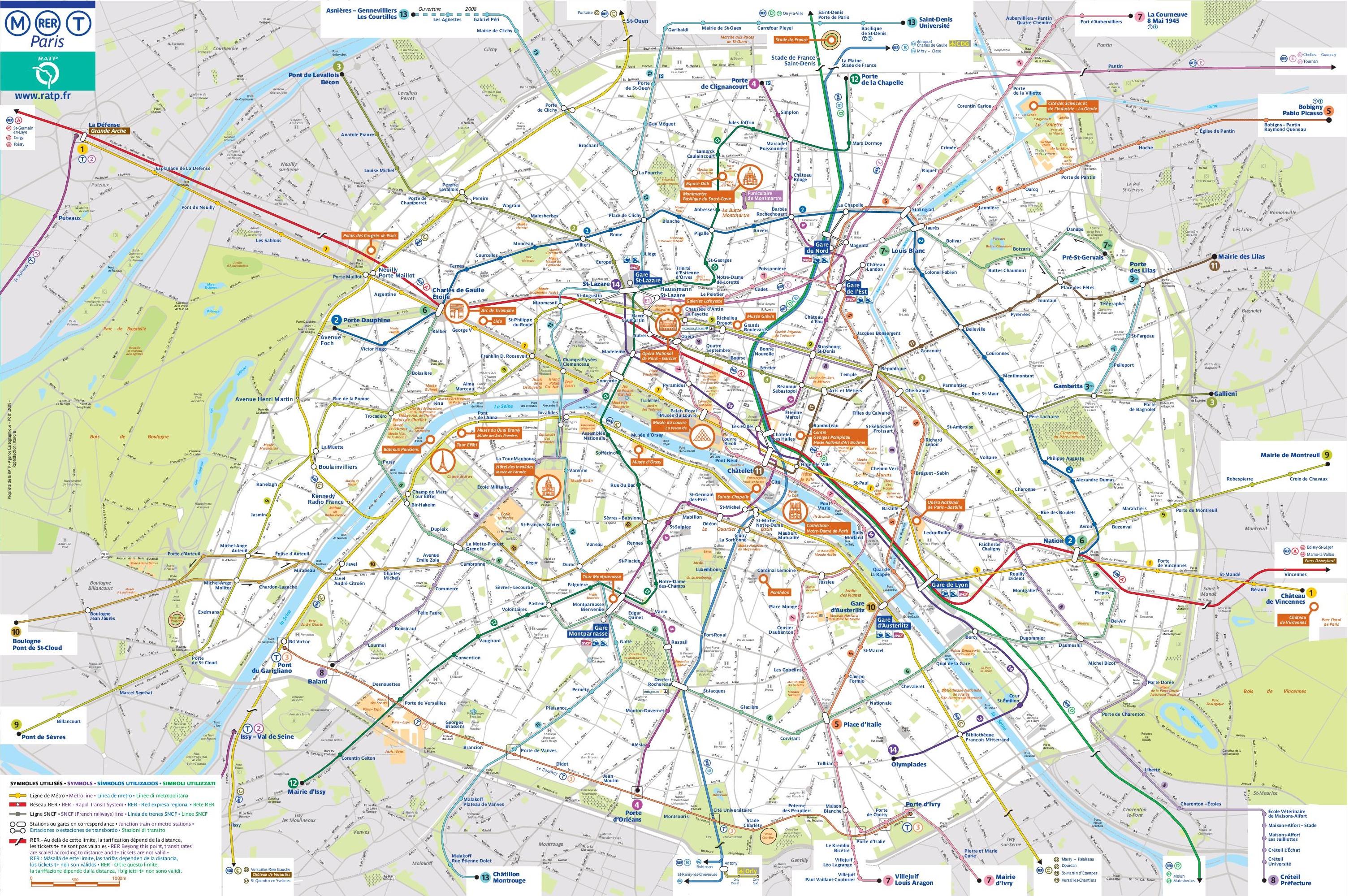
There are admittedly a few things that travelers can find confusing or downright unnerving about the French capital transport system (see Paris transport map). For one thing, trains and buses are more often than not overcrowded — and Paris status as one of the world most-visited cities does not help matters. For another, many Paris metro lines lack air-conditioning — positive from an ecological standpoint, but watch out for those summer steambaths (and grouchy travelers).
The Paris city government takes public transport very seriously, and every year a big chunk of the budget is reserved for improving traffic and passenger conditions in Paris trains, buses, and tramways as its shown in Paris transport map. In the coming years, you can expect Paris public transport to become more efficient, accessible and comfortable. Lots of new Paris stations are also being added, making it easier than ever to get around.