
search
Paris transport zones map
Paris transport map with zones. Paris transport zones map (Île-de-France - France) to print. Paris transport zones map (Île-de-France - France) to download. The (Paris Visite) travel card is available for one, two, three or five days, for either Paris transport zones 1–3 covering the centre of Paris, or transport zones 1–5 covering the whole of the network including the RER out to the airports, Versailles and Disneyland Paris as its shown in Paris transport zones map. It was conceived mainly for visitors to Paris and it is available through RATP's distributors in the UK, Switzerland and Belgium.
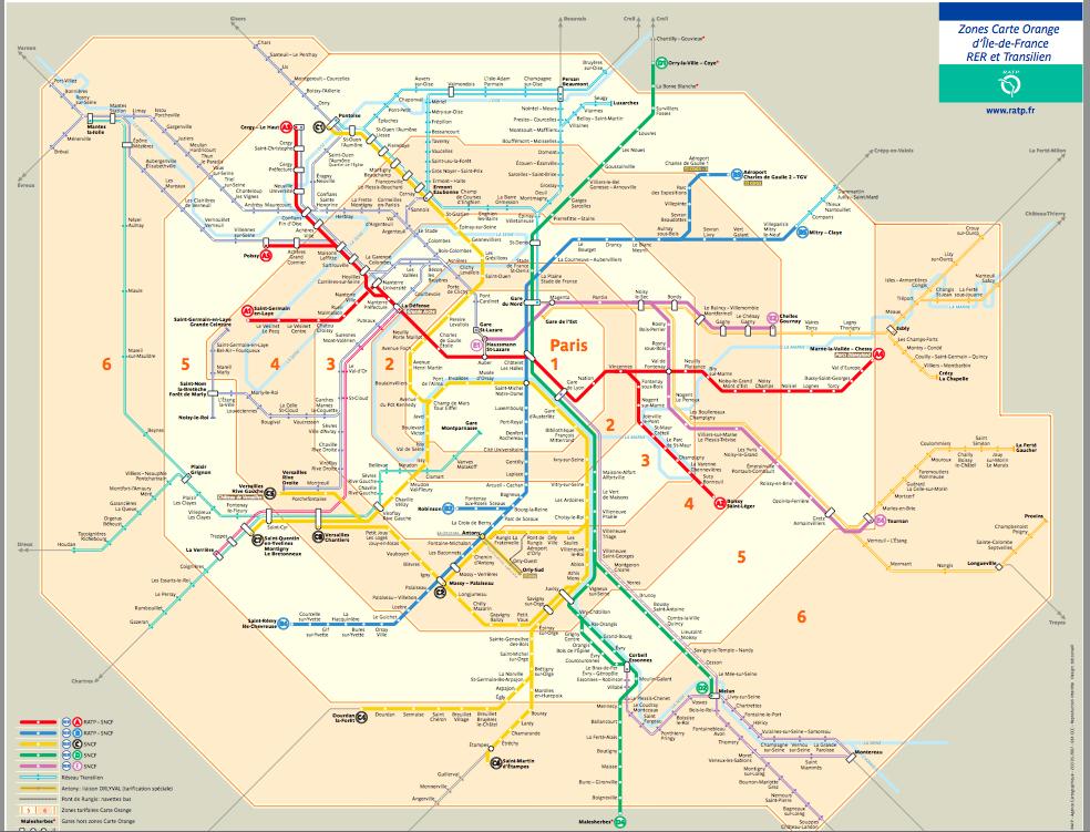
The Paris Navigo Monthly 2-zone passes (2-3, 3-4 and 4-5) are valid unlimited on the selected zones during the week as its shown in Paris transport zones map, and throughout the Paris Region on Saturdays, Sundays, public vacations, during the short school vacations in transport zone C (All Saints Day, Christmas, winter and spring) and from July 15 to August 15.