
search
Paris travel zones map
Map of Paris travel zones . Paris travel zones map (Île-de-France - France) to print. Paris travel zones map (Île-de-France - France) to download. The Paris Visite Travel card zones 1-3 entitles you to unlimited travel on the Paris public transport system in central Paris as its shown in Paris travel zones map - Metro, RER (fast metro), public buses, trams, and the Montmartre funicular. Zones 1-3 covers central Paris including Gare du Nord, the terminal for Eurostar (see "Download" section for Paris Metro travel zones maps).
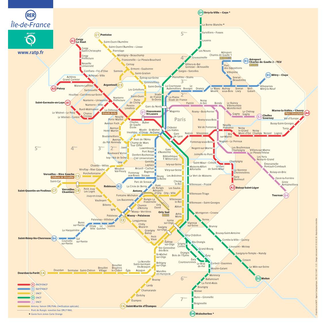
There is five travel zones in Paris transportation Service as its mentioned in Paris travel zones map. Service called Metro operate only in Zones 1 and 2. The RER operates until Zone 6. Those zones are located in Paris intramuros and its nearest suburbs. For Example, if you access Saint-Denis and la Dfense with le metro, your are in Zone 2. But if your access them with RER and bus, your are in zone 3.