
search
Ratp metro map
Paris ratp map. Ratp metro map (Île-de-France - France) to print. Ratp metro map (Île-de-France - France) to download. The ratp metro/Autonomous Operator of Parisian Transports is the major transit operator responsible for public transportation in Paris and its surroundings as its shown in ratp metro map. Ratp is under the authority of the Syndicat des transports d'Île-de-France (STIF), the Paris region transit authority. Its operational divisions include the Paris metro system (16 lines), part of the RER, an extensive bus system, and four tram lines. It also operates the Montmartre funicular.
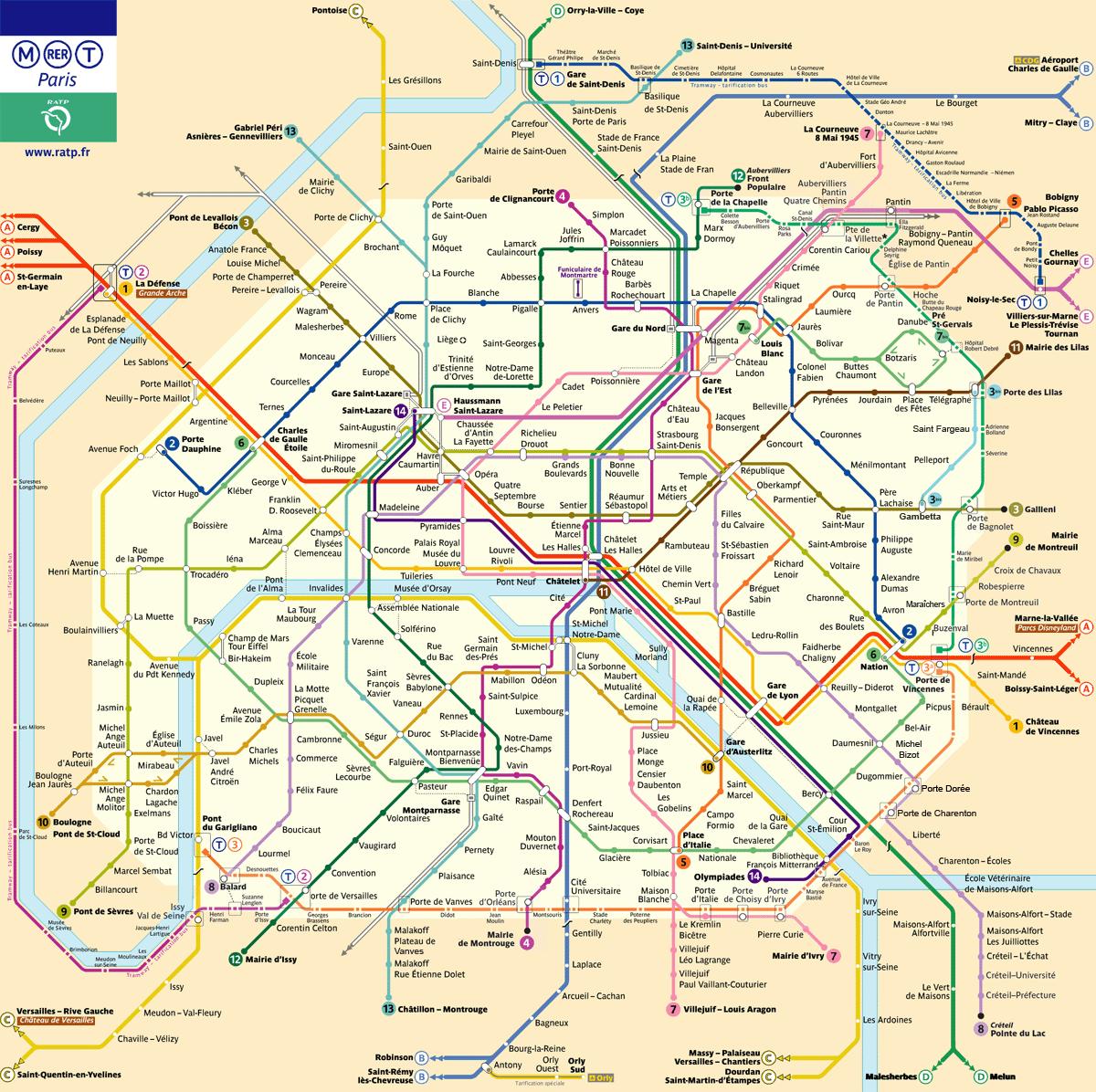
The ratp metro was created on March 21, 1948, by combining the assets of the Compagnie du chemin de fer métropolitain de Paris (CMP), which operated the Paris Metro, and the Société des transports en commun de la région parisienne (STCRP), which operated Paris bus system. Currently, the ratp metro operate a multi-mode public transportation infrastructure. In Île-de-France, the ratp operates buses, regional trains, trams and Metro services (see ratp metro map).
In Germany, Italy, and the USA, in association with their respective partners, the ratp metro operates and maintains regional buses and trains. Noctilien is the network of night buses in the Île-de-France region as its mentioned in ratp metro map. Currently there are projects under way to create new light rail lines. The ratp metro logo represents, in a stylized version, the Seine meandering through the Île-de-France region as the face of a person looking up.