
search
Rer d Paris map
Map of rer d Paris . Rer d Paris map (Île-de-France - France) to print. Rer d Paris map (Île-de-France - France) to download. The rer d Paris is one of the five lines in the rer rapid transit system serving Paris, France. The rer d line of Paris officially runs from the northern terminus Orry-la-Ville – Coye (D1) to the southern terminuses Melun (D2) and Malesherbes (D4) as its shown in rer d Paris map. In reality, some trains continue north to Creil except during rush hours, and the link between Juvisy-sur-Orge and Melun via Corbeil-Essonnes is operated by rer d Paris. Due to its high rate of incidents and social disturbances, rer d line is colloquially known as "RER poubelle" (Trash).
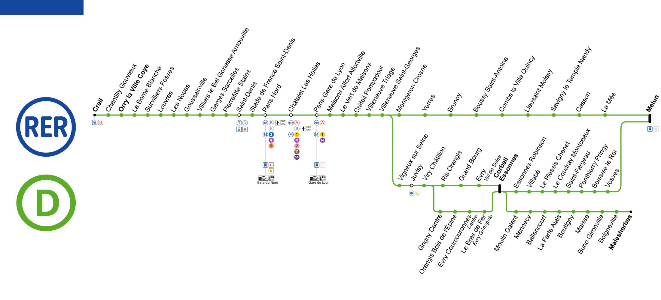
Rer d Paris links the Gare du Nord with the Gare de Lyon via Châtelet – Les-Halles as its mentioned in rer d Paris map. The section north of the Gare du Nord opened in the late 1980s; a dedicated tunnel opened in 1995 to connect it to the SNCF network south of the Gare de Lyon, part of which was transferred to the rer. The first inauguration of rer d Paris was in 27 September 1987.